The Center was initially managed by "Sapienza" University of Rome through the San Marco Project Research Center (CRSPM). Being located below the equator line on the coast of the Indian Ocean, the Center is ideal for both launches and ground-based satellite control activities. The Center is comprised a Sea Segment, which is its main offshore launch site, and a Land Segment, represented by the communications ground station on the mainland.
The Center's core business is the reception of satellite and telemetry data and the tracking of carriers or other space objects. This makes the Broglio Space Center an important hub in the cooperation network with other countries and space agencies, such as NASA, the European (ESA), French (CNES), Argentine (CONAE) space agencies, the Kenyan Space Agency and those of other African countries, as well as commercial operators, such as SpaceX. Its equatorial location enhances the Center's unique potential.
The Center is also engaged in developing research projects and training activities, including the setting up of the International Center for Space Education in Africa, which will make the "Luigi Broglio" Space Center a training hub for the whole Continent.
The Center was first established by Professor Luigi Broglio in the 1960s, who thought Malindi was the right logistical and environmental location to set up a high-level scientific facility while at the same time laying the groundwork for a unique and strategic partnership with Kenya. That was when the 'San Marco' equatorial launch base was born.
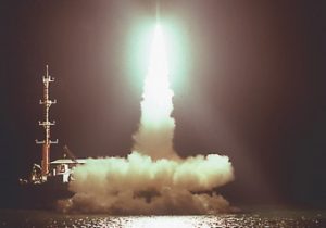
The Santa Rita and San Marco Ocean platforms were 'inaugurated' in 1967 when the San Marco-2 satellite was launched from the San Marco launch site. The partnership with NASA, which contributed to the project by providing launchers, was a key element in its overall success.
A total of 9 satellites took off from the Center between 1967 and 1988: 4 were part of the San Marco program, 4 were U.S. satellites and one was British. Some 20 orbital missions were also launched.
The Center (Longitude 40.19 degrees east – Latitude 2.99 degrees south) covers an area of about 3.5 hectares on the Indian Ocean coast about 32 km from Malindi. It can be reached traveling along the Kenyan coastline. The Center's presence in Kenya, which dates back to 1966, is currently governed by a renewable 15-year intergovernmental agreement, first signed in 1995. It envisagd activites such as launches, satellite-data reception, remote sensing and training activites to be carried out both in Italy and on site.
Italy has agreed to provide programs, equip and operate the Center, provide logistics, and train and employ local staff. In turn Kenya provides the site, upon payment of a modest fee and the commitment that Italy will train and employ local labor. The local government must be informed about the programs that can benefit from the support of the Center and requires, only for commercial programs, a royalty to be set on the basis of each commercial agreement. At the end of the 15-year period, the equipment will become the property of Kenya.
The last launch - a Scout launcher carrying the San Marco D/L satellite- was performed on March 25, 1988. Since then, the platforms have remained unused and subject only to routine maintenance.
The Land Segment is comprised of a series of masonry and wooden buildings that serve both as living quarters and service facilities, a marina for docking vessels connecting with the platforms, and 3 Ground Stations (antenna systems) for in-orbit control and the acquisition of telemetry from satellites and launchers. The 3 stations are:
S-Band Station, equipped with a 10-meter dish, used for ASI programs;
S/X/L Band Station, equipped with a 10-meter dish, engaged in monitoring launchers (Arianespace, Titan) and providing support to the initial phases of commercial satellites (LEOP)
and the X-Band Station, equipped with a 6-meter dish used to acquire remote sensing data (ERS2, Spot, Landsat).
The Center is connected to Italy via Intelsat satellites as part of the Italian Space Agency's ASI-net network.