

ASI's main operational center, located in Matera, Italy
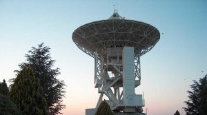
ASI's Space Center was established in 1983 in Matera, in the Murgia Terlecchia area, thanks to the joint effort of the CNR National Space Plan (succeeded in 1988 by the Italian Space Agency) and the Basilicata Region. The CGS is ASI's main operational center.
Space Geodesy has always been at the core of the Center 's activities, followed shortly after by Remote Sensing. The CGS enter has incorporated other sectors over time such as "free space" quantum telecommunications, "space junk" tracking, and time and frequency metrology.
Space Geodesy
Historically Space Geodesy was the pillar on which the Center was first established. It monitors the position of fiducial stations by means of multi-technology systems (laser telemetry of geodetic satellites or SLR, Very Long Baseline Interferometry or VLBI, GNSS positioning, absolute gravimetry) equipped with highly sophisticated, advanced instruments that make the Matera Space Center one of the key stations in the global geodetic network.
CGS activities play a key role in understanding the tectonics of the Mediterranean basin and a large number of geophysical and geodynamic parameters, as well as in developing the international Terrestrial Reference Frame. The same equipment is also used for other types of activities, including space navigation, astrometry, radio astronomy, telecommunications and fundamental physics.
ASI/CGS belongs to the International Association of Geodesy, and as such it is a member of the International Laser Ranging Service (ILRS), the International VLBI Service (IVS), the International GNSS Service (IGS) and the International Gravity Field Service (IGFS). It is both as an observation station and as a data analysis center. Since 2004, the CGS has been ILRS Primary Official Combination Center entrusted with the task of producing, on a weekly and daily basis, sets of global geodetic parameters developed by combining numerous independent solutions from laboratories around the world. On January 31, 2014 the CGS's satellite and lunar laser telemetry system, known as the Matera Laser Ranging Observatory (MLRO), was named after Rocco Petrone and "his extraordinary adventure from Basilicata to the Moon." Petrone, whose parents migrated to the U.S., was the director of the Apollo missions that took man to the moon.
Remote Sensing
In the early 1990s, ASI entered into an agreement with ESA to set up the Italian Processing and Archiving Facility (I-PAF) and, later, an agreement for the Italian Processing and Archiving Centre (I-PAC) to process data acquired from the ESA ERS-1/2 and ENVISAT satellite missions. The CGS also played a key role in the Italian-German-American missions SIR-C/X-SAR and SRTM with the acquisition of the first X-band satellite RADAR data.
The I-PAF/PAC has evolved into the National Multimission Center (CNM), which aims to acquire, process and archive remote sensing data and in particular data from satellites and instruments developed by the Italian Spaace Agency including ROSA (Radio Occultation for Sounding the Atmosphere) for the study of climate change through the technique of Radio Occultation and, shortly, PRISMA (PRecursor HyperSpectral Mission Application).
The COSMO-SkyMed Constellation
The COSMO-SkyMed mission is one of ASI's most important projects. It's an Earth-imaging constellation consisting of four identical satellites with X-band radar owned and operated by ASI (Agenzia Spaziale Italiana) and funded by the Italian Ministry of Defense. The Matera-based CGS operates Italy's Civil Ground Segment (I-CUGS) of this dual system.
COSMO-SkyMed (Constellation of Small Satellites for Mediterranean basin Observation) is one of the most innovative programs for Earth Observation and is the first space program designed for both civil (institutional and commercial) and military applications. Developed by the Italian Space Agency and the Ministry of Defense, the system is Italy's largest investment in the field of Earth Observation, whose construction involved the Italian industrial. community. COSMO-SkyMed consists of a constellation of four identical satellites carrying the Synthetic Aperture Radar (SAR-2000) with high-resolution X-band sensors equipped with an innovative transmitter/receiver system.
Conceived as a multi-mission system capable of integrating with other space systems to meet the demands of a wide user community, COSMO-SkyMed can operate in all weather and lighting conditions, with revisit times over the same geographic area of up to 12 hours and with rapid response times (from user request to product delivery) thus ensuring global coverage of the planet.
The COSMO Control Center is located at Telespazio's Fucino Space Center (L'Aquila, Italy), while e-GEOS at the Matera Space Center (an ASI/Telespazio joint venture) is in charge of acquiring, archiving, processing and distributing satellite data for civilian applications.
Quantum telecommunications
Ever since 2003 the CGS has been working closely with the Department of Information Engineering of the University of Padua in the field of "free-space" quantum telecommunications. The cooperation has resulted in several outstanding results that were published on international journals. The MLRO system is used to conduct these activities. It is equipped with a 1.5-meter-diameter telescope that being highly versatile can be easily adapted and used for these new applications.
Tracking space debris
The Italian Space Agency has tasked the CGS with tracking space debris which are a real danger to artificial satellites (first and foremost the international space station - ISS) that are still oeprational. An automatic passive debris tracking system is operational and will soon be supported by the MLRO system for active tracking (laser).
Time and frequency metrology
The CGS hosts one of the nodes of the INRIM (National Institute of Metrological Research) network targeted at the optical fiber synchronization of atomic frequency standards for experiments related to time and frequency metrology that find applications in the fields of quantum telecommunications and space geodesy.
The center's presentation brochure
Contacts:
ASI Space Center
Locality of Terlecchia snc
75100 Matera (MT)
Telephone: (+39) 0835-377 1
Fax: (+39) 0835-339005
E-Mail: segreteria.matera@asi.it
‣ No elements for this section
‣ Latest News
THURSDAY 16 JULY 2026

THURSDAY 21 MAY 2026
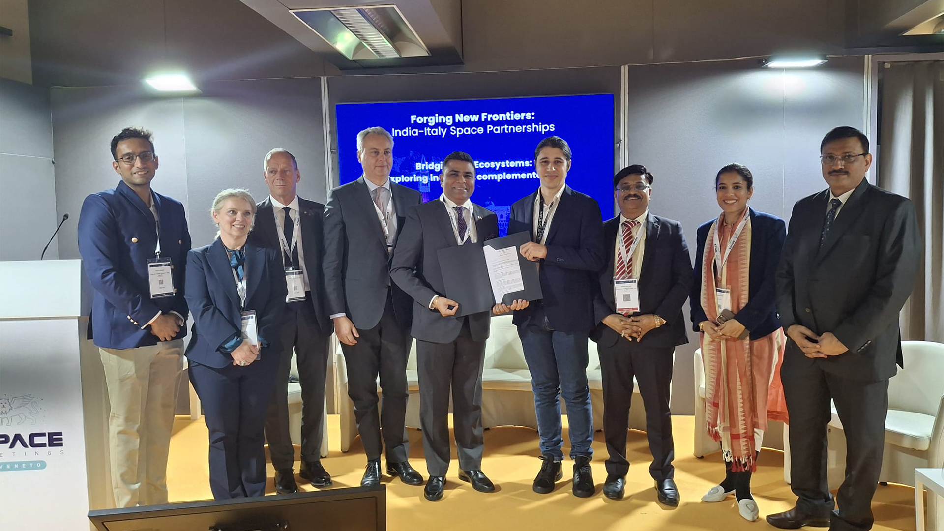
Promotion and dialogue activities in the space sector fall within the scope of the Italy-India Joint Strategic Action Plan 2025-2029 MORE...
TUESDAY 19 MAY 2026
Martin C. Weisskopf, born in Omaha, Nebraska in 1942 died on Saturday May 2, 2026, in Huntsville, Alabama. MORE...
FRIDAY 08 MAY 2026
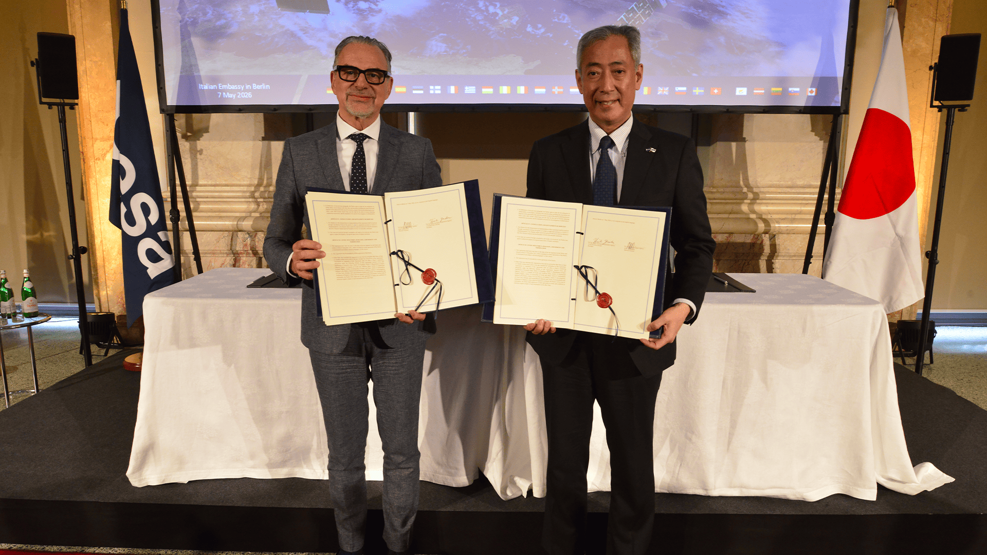
The cooperation agreement signed today at the Italian Embassy in Berlin for the mission with significant Italian participation MORE...