

ERS-1 (European Remote-Sensing satellite) was the first European Space Agency (ESA) mission in the context of Earth observation, designed to carry out the environmental monitoring, especially in the microwave spectrum. The satellite was launched on July 17th, 1991, aboard an Ariane 4 carrier from the spaceport in Kourou, French Guyana, and was placed in a sun-synchronous polar orbit.
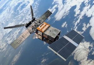
ERS-1 was located at an average altitude of about 780 km, and its set of instruments included, among other things, active and passive microwave sensors, a Synthetic Aperture Radar (SAR) and a thermal infrared radiometer; at the time, it was the most sophisticated and biggest European satellite (with a weight of 2400 km and a size of 12 x 12 x 2,5 meters).
The ERS-1’s instruments allowed to carry out a wide range of measurements in several fields of Earth observation: monitoring of oceans and polar ice caps, geology, bathymetry, monitoring of the territory and forest cover.
The ERS-1 mission ended on March 10th, 2020, due to a failure in the control system. Nevertheless, the satellite had already far exceeded its expected operating life, and in nearly 9 years of activity it completed 45.000 polar orbits and recorded more than 1 million images.
The ASI was also involved in this mission: at the beginning of the 90’s, in fact, the agency concluded an agreement with the ESA to develop the Italian Processing and Archiving Facility (I-PAF) and, subsequently, the Italian Processing and Archiving Centre (I-PAC), for the processing of the data acquired by the ERS-1 satellite and its successors ERS-2 and ENVISAT, which are ESA-branded too: both facilities are located by the Geodesy Centre of the Italian Space Agency in Matera.


