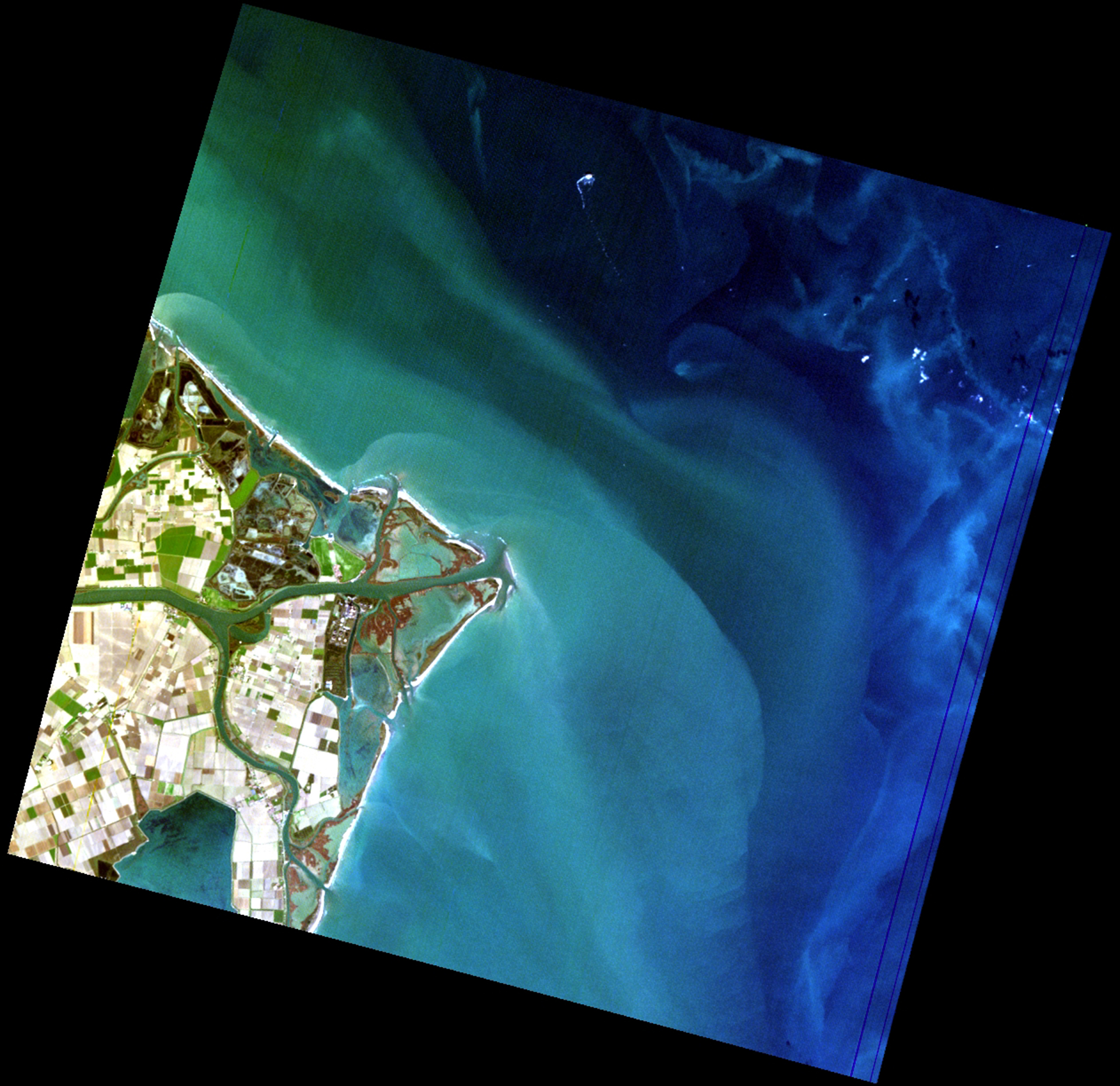
This image of the Po River Delta was acquired on the 24 November 2020 by the PRISMA sensor (PRecursore IperSpettrale della Missione Applicativa). Po, the longest river of Italy, flows through one of the most urbanized and productive (mainly agriculture and industry) regions of Europe and debouches in the Adriatic Sea. As seen in the true color image, the Po Delta is composed by various river branches, natural and cultivated emerged areas, wetlands and coastal lagoons. In the marine-coastal area there are waters with different characteristics: along the coast the clearest waters are due to sediments resuspended by wind and transported by long-shore current; offshore, typically marine blue waters are observed, with bright patches affected by algal blooms.
The image was elaborated in the framework of the ASI project “Sviluppo di Prodotti Iperspettrali Prototipali Evoluti” whose main objective is the prototyping of a subset of L3 / L4 value-added products to be retrieved by means of hyperspectral data processing. Among the prototypes that are planned to be developed, there is the Water Quality product that reports the following parameters: Phytoplankton, Total Suspended Matter, Bottom Substrate.
Data/Information generated by Federica Braga – Consiglio Nazionale delle Ricerche-Istituto di Scienze Marine (CNR-ISMAR), Mariano Bresciani and Claudia Giardino – Consiglio Nazionale delle Ricerche-Istituto per il Rilevamento Elettromagnetico dell’Ambiente-(CNR-IREA), under an ASI License to Use; Original PRISMA Product - © ASI – (2021)