


Thematic area: Earth Observation
Mission responsibility: Italian Government – ESA – ASI
Launch dates: January 14, 2025 (1 Pathfinder minisatellite Hawk for Earth Observation – HEO); June 23, 2025 (7 Pathfinder minisatellites Hawk for Earth Observation – HEO); November 28, 2025 (8 Eaglet II minisatellites); March 30, 2026 (8 Eaglet II satellites)
Description
IRIDE is a satellite constellation for Earth Observation, one of the most important European space initiatives in this sector, entirely developed in Italy at the initiative of the Italian Government.
The programme is managed by the European Space Agency (ESA) with the support of the Italian Space Agency (ASI) and funded through the National Recovery and Resilience Plan (PNRR) and the National Complementary Plan (PNC).
The upstream segment consists of six satellite constellations that observe the Earth using optical and radar sensors.
The remotely sensed data are transmitted from the satellites to the downstream segment, where they are processed and subsequently used to deliver services to users.
The six constellations differ in the types of onboard sensors: radar sensors that observe the Earth day and night in any atmospheric condition; optical sensors that observe the Earth with different spatial and spectral resolutions in the visible and infrared spectrum.
The wide range of radar and optical sensors enables the detection of specific features and characteristics of the Earth's surface, which form the basis for the services provided by IRIDE.
For these reasons, the IRIDE upstream segment can be counted among the most complex and comprehensive "Constellations of Satellite Constellations" in the world.
Objectives
The constellation is used for environmental monitoring, natural resource management, civil protection, and the development of commercial applications based on satellite data.
IRIDE offers a wide range of geospatial services to all users. These geospatial services, designed according to user needs, provide information (maps, monitoring, multi-temporal analyses) relating to land and sea through the processing of satellite Earth Observation data and integration with other data from models, ground networks, and other available or user-supplied data. The application domains, defined by users, for which the IRIDE Services Segment provides geospatial products are: marine and coastal monitoring; security; land cover; hydro-meteo-climate; water resource management; air quality; emergencies; ground movement.
HEO Pathfinder Launch and First Image
On January 14, 2025, the Pathfinder Hawk for Earth Observation (HEO) — the first microsatellite of the IRIDE constellation — was successfully launched aboard a SpaceX Falcon 9 rocket from Vandenberg Base in California.
The satellite, developed by Argotec in collaboration with Officina Stellare, serves as the trailblazer of the constellation and transmitted the first image from space: a view of Rome showing the Stadio Olimpico, the Tiber River, and St. Peter's Basilica.
Launch of the HEO Constellation
On June 23, 2025, seven HEO (Hawk for Earth Observation) satellites of the IRIDE programme were successfully launched aboard a SpaceX Falcon 9 rocket from Vandenberg Base in California, as part of the Transporter-14 mission. Signal acquisition was confirmed by Argotec's mission control centre approximately four hours after launch.
The seven minisatellites, each weighing approximately 60 kg, join HEO Pathfinder, the programme's first satellite, already in orbit since January 2025.
Launch of the Eaglet II Constellation
On November 28, 2025, eight Eaglet II minisatellites were launched into orbit aboard a SpaceX Falcon 9 rocket from Vandenberg Base, as part of the Transporter-15 mission. The satellites, each weighing approximately 25 kg and developed by OHB Italia in collaboration with Optec, constitute the first part of the second constellation of the IRIDE programme.
A few hours after launch, OHB Italia's control centre in Rome received the first telemetry signals, initiating the Launch and Early Orbit Phase (LEOP) and confirming the correct status of the vehicles. With these launches, the programme reached a total of sixteen satellites in orbit, meeting the PNRR objective regarding the deployment of the first multi-sensor constellations seven months ahead of schedule.
The Eaglet II satellites represent a new generation of small Earth observation satellites, equipped with multispectral electro-optical sensors for high-resolution imaging and a low-latency X-band transmission system. In addition to remote sensing, they integrate a payload for receiving and retransmitting AIS (Automatic Identification System) messages, contributing to maritime tracking and persistent surveillance.
Additional satellites of the HEO and Eaglet II constellations will be launched throughout 2026, forming an initial core of the Earth observation system whose full deployment is scheduled for the end of 2028 with the launch of new constellations entrusted to other industrial groups.
Download the brochure.
Watch the video
Photo gallery
-
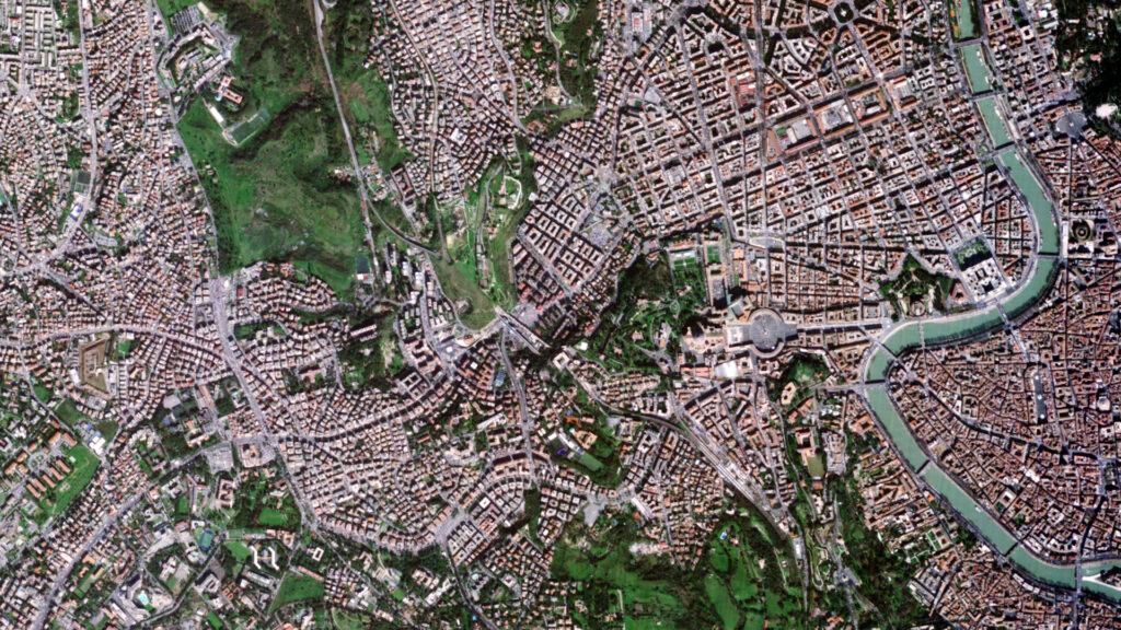
- The first image from space taken by HEO Pathfinder: a view of Rome showing the Stadio Olimpico, the Tiber River, and St. Peter’s Basilica. Credits: IRIDE Programme
-
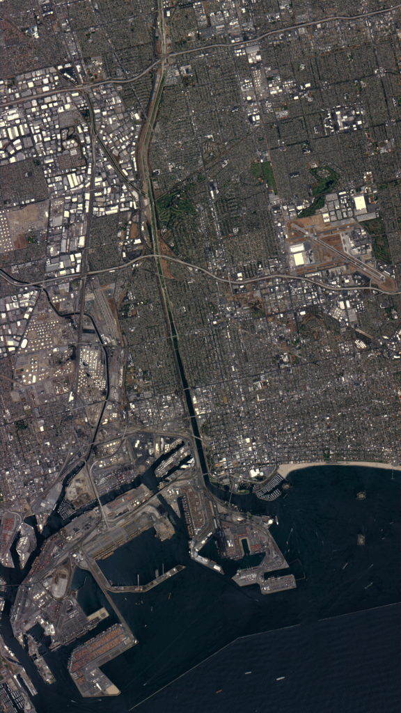
- The city of Los Angeles as seen by the HEO Pathfinder satellite. Credits: IRIDE Programme
-
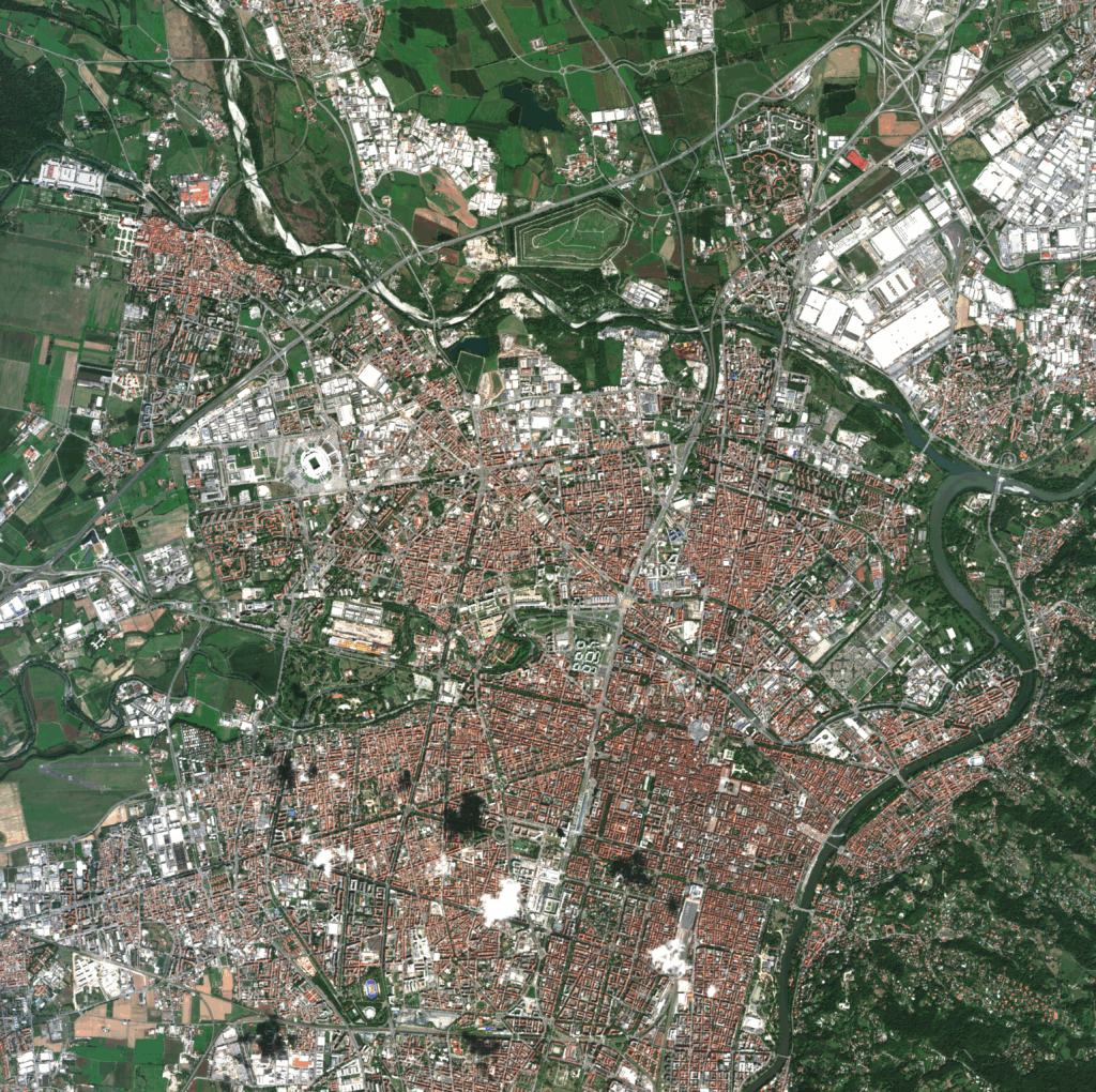
- The city of Turin observed by the HEO Pathfinder satellite during the 2026 Winter Olympics. Credits: IRIDE Programme
-
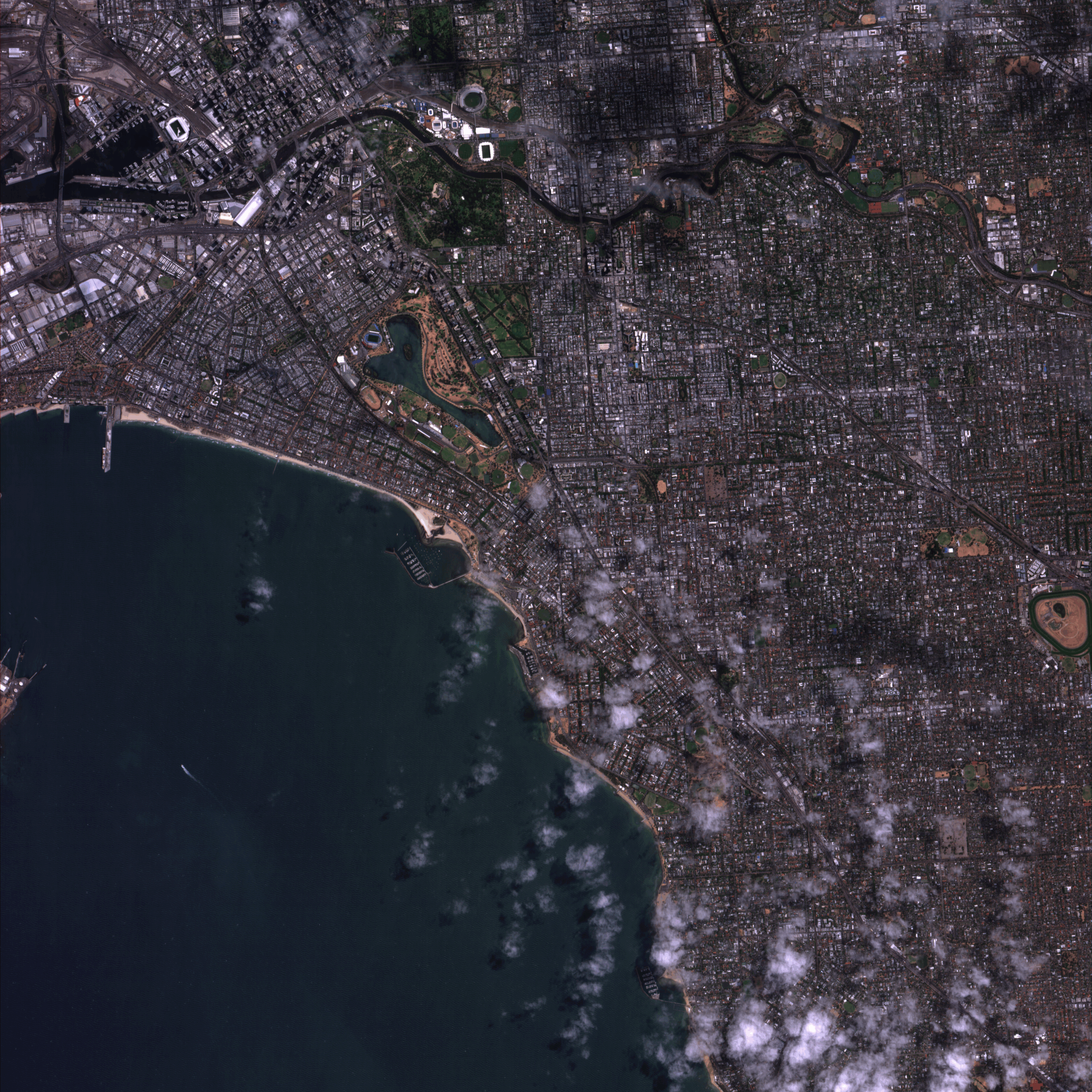
- Melbourne Park and Rod Laver Arena observed by the HEO Pathfinder satellite during the Australian Open. Credits: IRIDE Programme
-
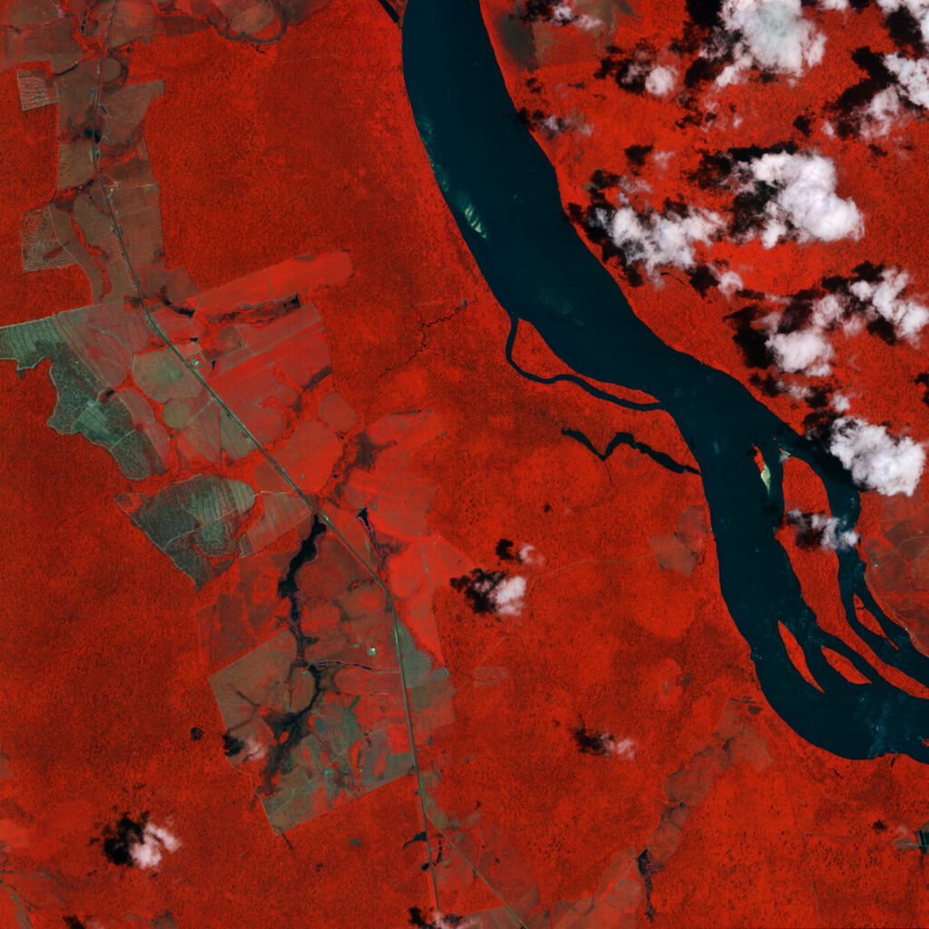
- False-colour image (black) of the Rio Branco river near the city of Boa Vista, Brazil, observed by the HEO Pathfinder satellite. Credits: IRIDE Programme
-
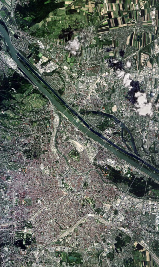
- The Austria Center in Vienna during the 2025 ESA Living Planet Symposium, as seen by the HEO Pathfinder satellite. Credits: IRIDE Programme
-

- Monte Civetta, one of the venues chosen for the 2026 Winter Olympics, observed by the HEO Pathfinder satellite and Copernicus Sentinel-2. Credits: IRIDE Programme, ESA


